blind spots
interactive map and route tracer
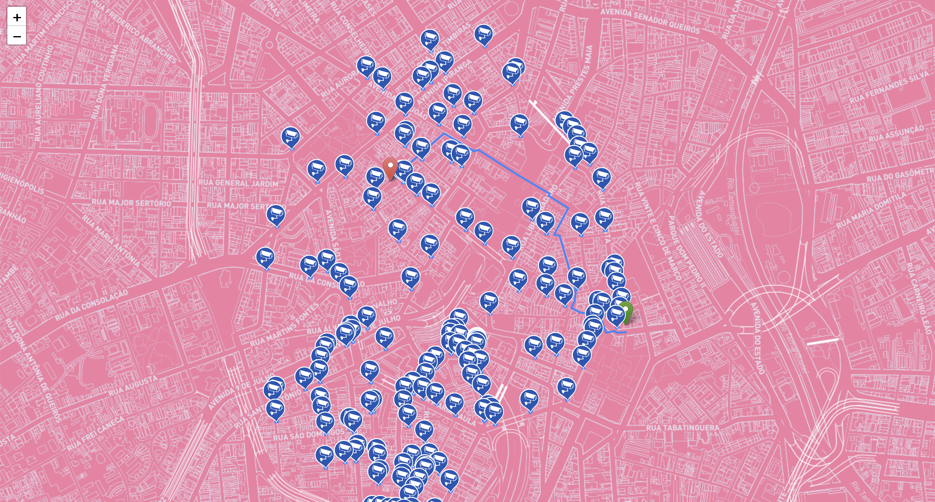
Map for the Blind Spots project.
The map shows video surveillance cameras, automatically mapped using a device created especially for this project.
The map also has a route tracer that allows you to create routes from point A to point B in a mapped area, passing only through camera blind spots.
Interactive version here.


Desenho do mapa: Sara Lana
Desenvolvimento do traçador de rotas: Ewald Santos